2012
SN7580 : View across the Rheidol valley
taken 12 years ago, near to Ponterwyd, Ceredigion/Sir Ceredigion, Wales
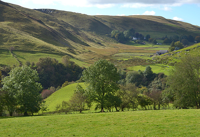
View across the Rheidol valley
The Rheidol itself is buried in the deep gorge which can just be made out in the lower third of the picture. Beyond, a minor valley houses the farm of Bryn-brâs, which can be seen on the right of the picture. In the distance lies the small cluster of houses at Troed-yr-Henrhiw.
 Map © Crown Copyright")
TIP: Click the map for more Large scale mapping
- Grid Square
- SN7580, 41 images (more nearby 🔍)
- Photographer
- Nigel Brown (more nearby)
- Date Taken
- Saturday, 6 October, 2012 (more nearby)
- Submitted
- Saturday, 6 October, 2012
- Subject Location
-
OSGB36:
 SN 7527 8011 [10m precision]
WGS84: 52:24.2843N 3:50.0949W - Camera Location
-
OSGB36: SN 7527 8011
- View Direction
- WEST (about 270 degrees)