1993
SK1614 : Bridge 49 Trent and Mersey Canal
taken 31 years ago, near to Alrewas, Staffordshire, England
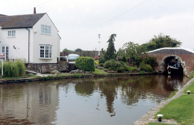
Bridge 49 Trent and Mersey Canal
The Trent and Mersey Canal is 93·5 miles in length from Derwent Mouth to Preston Brook. The first cut was made by Josiah Wedgwood in July 1766 at Middleport (Stoke-on-Trent). The eastern section between Derwent Mouth and Shugborough (the junction with the Staffordshire and Worcestershire Canal) was already operational by 1770 and the whole canal through to Preston Brook, where it linked with the Bridgewater Canal was open for business by 1777. James Brindley was the engineer until his death in 1772. There are seventy-six locks en route to raise and lower the water level where hills impede the course. There are four tunnels, including the famous Harecastle Tunnel near Stoke-on-Trent.
See other images of Trent and Mersey Canal
See other images of Trent and Mersey Canal
 Map © Crown Copyright")
TIP: Click the map for more Large scale mapping
- Grid Square
- SK1614, 84 images (more nearby 🔍)
- Photographer
- Jo and Steve Turner (more nearby)
- Date Taken
- Saturday, 14 August, 1993 (more nearby)
- Submitted
- Sunday, 7 October, 2012
- Subject Location
-
OSGB36:
 SK 16544 14923 [1m precision]
WGS84: 52:43.9018N 1:45.3865W - Camera Location
-
OSGB36: SK 16571 14928
- View Direction
- WEST (about 270 degrees)