2012
SP0481 : Narrows on the Worcester & Birmingham Canal
taken 12 years ago, near to Bournville, Birmingham, England
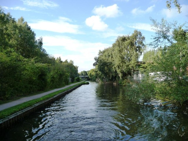
Narrows on the Worcester & Birmingham Canal
'Narrows' are places where a canal is intentionally built at its minimum width. Sometimes they are the site of a demolished bridge. More often [and I think in this case] they are points where stop planks can be dropped in across the canal, to close it. This would stop all the water draining out of a long pound if there was a breach somewhere.
 Map © Crown Copyright")
TIP: Click the map for more Large scale mapping
- Grid Square
- SP0481, 242 images (more nearby 🔍)
- Photographer
- Christine Johnstone (more nearby)
- Date Taken
- Tuesday, 4 September, 2012 (more nearby)
- Submitted
- Thursday, 11 October, 2012
- Subject Location
-
OSGB36:
 SP 0496 8164 [10m precision]
WGS84: 52:25.9630N 1:55.7084W - Camera Location
-
OSGB36: SP 0497 8159
- View Direction
- North-northwest (about 337 degrees)