2007
SO1633 : Talgarth Hospital
taken 17 years ago, near to Talgarth, Powys, Wales
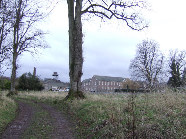
Talgarth Hospital
Talgarth Hospital was built on part the Chancefield Estate just to the south-east of the town in the early years of the 20th century as a lunatic asylum, together with a detached chapel, workers' houses and cottages and other ancillary works.
Now closed.
Now closed.
 Map © Crown Copyright")
TIP: Click the map for more Large scale mapping
- Grid Square
- SO1633, 11 images (more nearby 🔍)
- Photographer
- Jonathan Billinger (more nearby)
- Date Taken
- Friday, 19 January, 2007 (more nearby)
- Submitted
- Monday, 22 January, 2007
- Subject Location
-
OSGB36:
 SO 161 331 [100m precision]
WGS84: 51:59.4322N 3:13.3613W - Camera Location
-
OSGB36: SO 160 332
- View Direction
- Southeast (about 135 degrees)