TQ6475 : Nearing Tilbury Passenger Ferry
taken 12 years ago, near to Gravesend, Kent, England
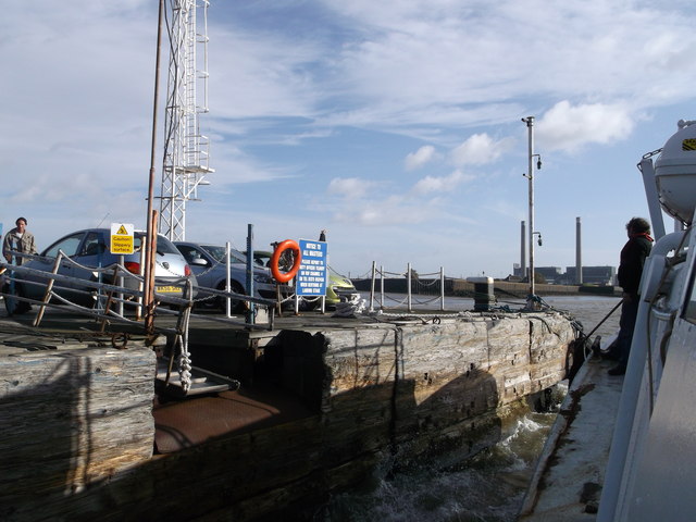
In the background is Tilbury Power Station.
The Gravesend - Tilbury Ferry is a passenger ferry across the River Thames east of London. It links Gravesend and Tilbury, and is the last publicly accessible crossing point before the Thames reaches the sea. The ferry is currently operated by the 'Lower Thames and Medway Passenger Boat Company' and runs every 30 minutes between about 6 am and 7 pm from Monday to Saturday. The ferry operation is subsidised by both Thurrock Council and Kent County Council.
The River Thames rises at Thames Head in Gloucestershire on the slopes of the Cotswolds and flows generally eastward to its mouth near Southend in Essex. At 215 miles long it is one of the longest rivers in Britain, and the longest entirely within England. It is one of the most important rivers in Britain. Link

 Map © Crown Copyright")
- Grid Square
- TQ6475, 206 images (more nearby 🔍)
- Photographer
- David Anstiss (more nearby)
- Date Taken
- Tuesday, 16 October, 2012 (more nearby)
- Submitted
- Wednesday, 17 October, 2012
- Subject Location
-
OSGB36:
 TQ 6455 7505 [10m precision]
WGS84: 51:27.0316N 0:22.0038E - Camera Location
-
OSGB36: TQ 6453 7504
- View Direction
- Northeast (about 45 degrees)