2007
NT2273 : Entrance to the Roseburn Path at Ravelston Dykes
taken 17 years ago, 3 km from Corstorphine, Edinburgh, Scotland
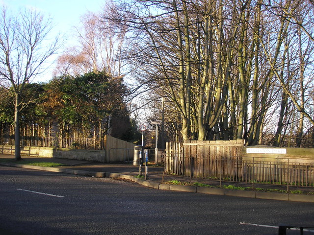
Entrance to the Roseburn Path at Ravelston Dykes
The view of the path which leads down to the Roseburn Path (the Murrayfield to Craigleith section of the now disused Granton and Leith branch line of the former Caledonian Railway).
The street sign for Ravelston Dykes (on the right of the picture) is attached to the bridge which carries the road over the walkway and cyclepath that follows the route of the disused railway line.
The street sign for Ravelston Dykes (on the right of the picture) is attached to the bridge which carries the road over the walkway and cyclepath that follows the route of the disused railway line.
 Map © Crown Copyright")
TIP: Click the map for more Large scale mapping
- Grid Square
- NT2273, 192 images (more nearby 🔍)
- Photographer
- Sandy Gemmill (more nearby)
- Date Taken
- Monday, 22 January, 2007 (more nearby)
- Submitted
- Tuesday, 23 January, 2007
- Subject Location
-
OSGB36:
 NT 228 738 [100m precision]
WGS84: 55:57.0603N 3:14.2698W - View Direction
- Northwest (about 315 degrees)