2012
TQ4666 : North from the Walnuts Car Park
taken 12 years ago, near to Orpington, Bromley, England
This is 1 of 2 images, with title North from the Walnuts Car Park in this square
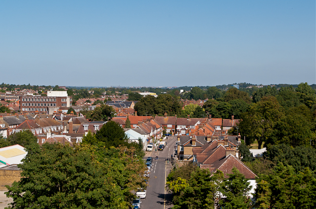
North from the Walnuts Car Park
Looking down on Bruce Grove (in the foreground) and Aynscombe Angle (beyond) from the roof of the Walnuts Car Park. On the left is Allied House (see TQ4666 : Allied House, Orpington) and in the far disctance towards the right of the photo is the former Horton Tower in St Mary Cray (see TQ4768 : Horton Tower, St Mary Cray), here in the process of being demolished.
 Map © Crown Copyright")
TIP: Click the map for more Large scale mapping
- Grid Square
- TQ4666, 634 images (more nearby 🔍)
- Photographer
- Ian Capper (more nearby)
- Date Taken
- Wednesday, 5 September, 2012 (more nearby)
- Submitted
- Saturday, 27 October, 2012
- Subject Location
-
OSGB36:
 TQ 464 665 [100m precision]
WGS84: 51:22.7504N 0:6.1987E - Camera Location
-
OSGB36: TQ 464 663
- View Direction
- North-northeast (about 22 degrees)