1967
NG4173 : Lùb an Sgòir in 1967
taken 57 years ago, near to Duntulm, Isle of Skye, Scotland
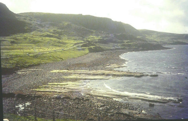
Lùb an Sgòir in 1967
Seen from the A855 road, which is seen following the coastline above the bay.
 Map © Crown Copyright")
TIP: Click the map for more Large scale mapping
- Grid Square
- NG4173, 53 images (more nearby 🔍)
- Photographer
- John Baker (more nearby)
- Date Taken
- 3 September 1967 (more nearby)
- Submitted
- Saturday, 27 October, 2012
- Subject Location
-
OSGB36:
 NG 4106 7391 [10m precision]
WGS84: 57:40.8162N 6:20.7234W - Camera Location
-
OSGB36: NG 4109 7399
- View Direction
- South-southwest (about 202 degrees)