2012
J3267 : Path, the Giant's Ring, Belfast
taken 11 years ago, near to Drumbeg, Co Down, Northern Ireland
Path, the Giant's Ring, Belfast
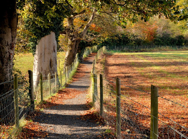
The start of the path leading from the Giants Ring J3267 : The Giant's Ring, Belfast (2012-1) to the Ballynahatty and Edenderry Roads. There are other paths running off which are not in the same good condition.
A walk from Minnowburn to the Giant's Ring, Belfast :: J3268
A series of photographs, taken on 3 November 2012, during a circular walk from the Minnowburn Bridge to the Giants Ring and back. There had been an overnight frost, some of which lingered in the shadows, but otherwise the weather was mostly sunny. Despite the recent rain many of the trees still retained their autumn leaves.
Loading map... (JavaScript required)
- Grid Square
- J3267, 96 images (more nearby 🔍)
- Photographer
- Albert Bridge (more nearby)
- Date Taken
- Saturday, 3 November, 2012 (more nearby)
- Submitted
- Sunday, 4 November, 2012
- Subject Location
-
Irish:
 J 325 675 [100m precision]
WGS84: 54:32.3577N 5:57.1304W - Camera Location
-
Irish: J 326 676
- View Direction
- West-southwest (about 247 degrees)