2012
SN6000 : River Lliw passes under M4 south-west of Pontlliw
taken 12 years ago, near to Pontlliw, Swansea/Abertawe, Wales
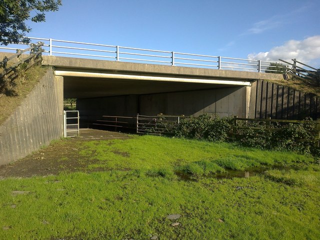
River Lliw passes under M4 south-west of Pontlliw
The river is culverted here to pass under the motorway. The footpath used to cross the motorway over a footbridge further north (SN603006) but that has now ceased to exist and so this is now the only to cross the motorway. This is the view looking North-East
 Map © Crown Copyright")
TIP: Click the map for more Large scale mapping
- Grid Square
- SN6000, 33 images (more nearby 🔍)
- Photographer
- Mama Herb (more nearby)
- Date Taken
- Saturday, 6 October, 2012 (more nearby)
- Submitted
- Tuesday, 6 November, 2012
- Subject Location
-
OSGB36:
 SN 6035 0034 [10m precision]
WGS84: 51:41.0642N 4:1.2886W - Camera Location
-
OSGB36: SN 6029 0029
- View Direction
- Northeast (about 45 degrees)