2007
TL0691 : Disused Railway Track near Warmington
taken 17 years ago, near to Tansor, North Northamptonshire, England
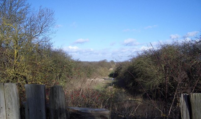
Disused Railway Track near Warmington
Viewed from the Warmington to Fotheringhay road, this photo of the long disused
Northampton-Peterborough Branch of the LNWR looks between the hedgelines northeastwards towards Peterborough. The track bed is slowly filling with agricultural and building debris.
Northampton-Peterborough Branch of the LNWR looks between the hedgelines northeastwards towards Peterborough. The track bed is slowly filling with agricultural and building debris.
 Map © Crown Copyright")
TIP: Click the map for more Large scale mapping
- Grid Square
- TL0691, 20 images (more nearby 🔍)
- Photographer
- Nigel Stickells (more nearby)
- Date Taken
- Sunday, 21 January, 2007 (more nearby)
- Submitted
- Friday, 26 January, 2007
- Subject Location
-
OSGB36:
 TL 062 915 [100m precision]
WGS84: 52:30.6633N 0:26.1947W - Camera Location
-
OSGB36: TL 062 915
- View Direction
- Northeast (about 45 degrees)