2005
NT1959 : Site of hill fort, Eight Mile burn
taken 19 years ago, near to Silverburn, Midlothian, Scotland
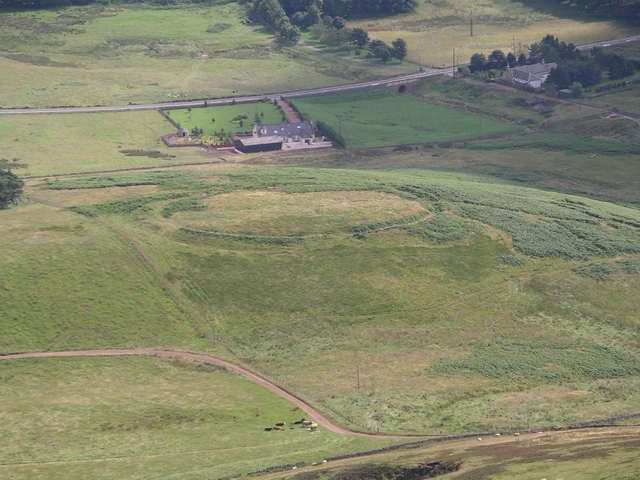
Site of hill fort, Eight Mile burn
The circular embankment and ditch can still be seen through the bracken
 Map © Crown Copyright")
TIP: Click the map for more Large scale mapping
- Grid Square
- NT1959, 21 images (more nearby 🔍)
- Photographer
- Chris Eilbeck (more nearby)
- Date Taken
- Sunday, 31 July, 2005 (more nearby)
- Submitted
- Sunday, 31 July, 2005
- Subject Location
-
OSGB36:
 NT 19 59 [1000m precision]
WGS84: 55:49.3207N 3:17.1842W