2012
NS5764 : Kingston Bridge at sunset
taken 11 years ago, near to Glasgow, Scotland
This is 1 of 14 images, with title starting with Kingston in this square
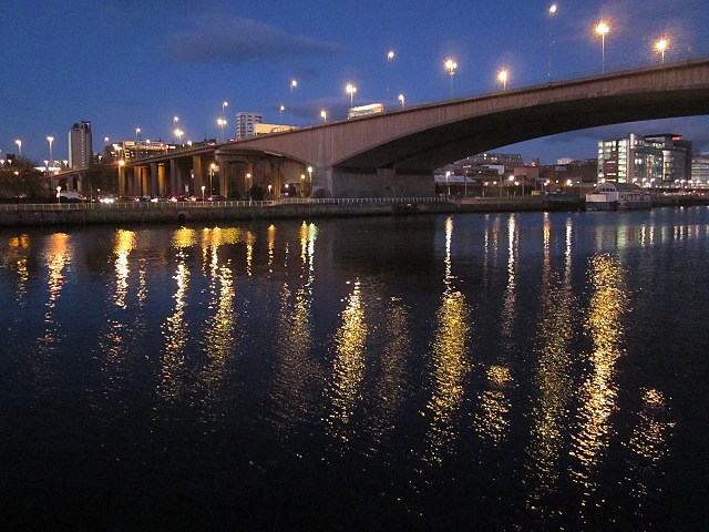
Kingston Bridge at sunset
The M8 motorway bridge across the River Clyde viewed from the south side of the river downstream of the bridge. Taken on a November evening after sunset.
M8 Motorway
The M8 is a 60 mile long motorway joining Edinburgh and Glasgow. It is one of the busiest roads in Scotland. The M8 is almost unique in Britain, in that it cuts straight through a major urban area (Glasgow), almost dividing the city in two. It was constructed between 1965-1995.
Wikipedia: Link
 Map © Crown Copyright")
TIP: Click the map for more Large scale mapping
- Grid Square
- NS5764, 303 images (more nearby 🔍)
- Photographer
- Patrick Mackie (more nearby)
- Date Taken
- Monday, 5 November, 2012 (more nearby)
- Submitted
- Saturday, 10 November, 2012
- Subject Location
-
OSGB36:
 NS 5797 6489 [10m precision]
WGS84: 55:51.3731N 4:16.2363W - Camera Location
-
OSGB36: NS 5779 6479
- View Direction
- East-northeast (about 67 degrees)