2012
TQ1409 : Downhill towards No Man's Land
taken 11 years ago, 3 km from Findon, West Sussex, England
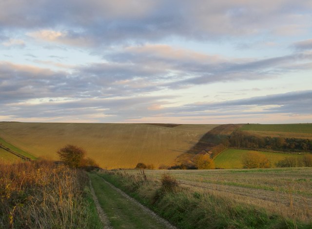
Downhill towards No Man's Land
Shot taken about half an hour before sunset on a November afternoon. The tree to the left of the byway is also to be seen (from the opposite direction) in Dave Spicer's snowy contribution: Link
The name 'No Man's Land' is puzzling, but by no means unique. I know of a SU2517 : Nomansland, Hampshire - except that it turns out to be in Wiltshire (well, mostly Link ) , which goes a long way towards explaining the name. There are plenty of other No Man's Lands - even the quickest Geograph search turns up instances in Hertfordshire, Devon and Cornwall (and there's another one in Hampshire, near Winchester).
The name 'No Man's Land' is puzzling, but by no means unique. I know of a SU2517 : Nomansland, Hampshire - except that it turns out to be in Wiltshire (well, mostly Link ) , which goes a long way towards explaining the name. There are plenty of other No Man's Lands - even the quickest Geograph search turns up instances in Hertfordshire, Devon and Cornwall (and there's another one in Hampshire, near Winchester).
 Map © Crown Copyright")
TIP: Click the map for more Large scale mapping
- Grid Square
- TQ1409, 27 images (more nearby 🔍)
- Photographer
- Stefan Czapski (more nearby)
- Date Taken
- Thursday, 8 November, 2012 (more nearby)
- Submitted
- Saturday, 10 November, 2012
- Subject Location
-
OSGB36:
 TQ 149 096 [100m precision]
WGS84: 50:52.5061N 0:22.0378W - Camera Location
-
OSGB36: TQ 148 097
- View Direction
- East-southeast (about 112 degrees)