2012
SD7198 : Ruined barn, Murthwaite
taken 11 years ago, near to Fell End, Cumbria, England
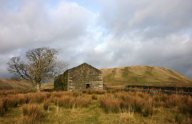
Ruined barn, Murthwaite
This large barn beside the footpath north of Murthwaite is missing its roof and the walls are starting to collapse. Harter Fell beyond.
 Map © Crown Copyright")
TIP: Click the map for more Large scale mapping
- Grid Square
- SD7198, 26 images (more nearby 🔍)
- Photographer
- Karl and Ali (more nearby)
- Date Taken
- Sunday, 11 November, 2012 (more nearby)
- Submitted
- Monday, 12 November, 2012
- Subject Location
-
OSGB36:
 SD 7139 9868 [10m precision]
WGS84: 54:22.9681N 2:26.5206W - Camera Location
-
OSGB36: SD 7138 9865
- View Direction
- North-northeast (about 22 degrees)