2007
SK1290 : Cowms Rocks
taken 17 years ago, 5 km N of Edale, Derbyshire, England
This is 1 of 2 images, with title Cowms Rocks in this square
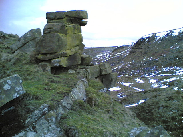
Cowms Rocks
This minor gritstone edge (right) north of the Snake Pass is obscured from view from both the A57 road and the old Roman road followed by the public footpath by the curve of the intervening slope. Below the edge is a large area of landslipped debris, of which the tor in the foreground is part (the Google Earth image shows this very well). The path on the western side of Oyster Clough (SK1190) in the distance in the centre of the picture is made more obvious by lingering snow.
 Map © Crown Copyright")
TIP: Click the map for more Large scale mapping
- Grid Square
- SK1290, 8 images (more nearby 🔍)
- Photographer
- Dave Dunford (more nearby)
- Date Taken
- Saturday, 27 January, 2007 (more nearby)
- Submitted
- Saturday, 27 January, 2007
- Subject Location
-
OSGB36:
 SK 122 905 [100m precision]
WGS84: 53:24.6973N 1:49.0578W - Camera Location
-
OSGB36: SK 125 903
- View Direction
- Northwest (about 315 degrees)