2012
SK2701 : Hoo Hill beyond Polesworth
taken 11 years ago, near to Polesworth, Warwickshire, England
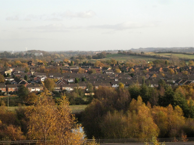
Hoo Hill beyond Polesworth
Beyond Polesworth's northern estates Hoo Hill, right of centre, a low northern spur of the Arden plateau, drops sharply down to the floodplain of the River Anker. Hoo has the same meaning as hoe, howe and heugh: a spur of land, "a height enduring abruptly or steeply". The viewpoint is the mound of mine spoil in Pooley Country Park north of the village.
 Map © Crown Copyright")
TIP: Click the map for more Large scale mapping
- Grid Square
- SK2701, 74 images (more nearby 🔍)
- Photographer
- Robin Stott (more nearby)
- Date Taken
- Sunday, 11 November, 2012 (more nearby)
- Submitted
- Monday, 12 November, 2012
- Subject Location
-
OSGB36:
 SK 273 017 [100m precision]
WGS84: 52:36.7490N 1:35.8863W - Camera Location
-
OSGB36: SK 256 037
- View Direction
- Southeast (about 135 degrees)