2012
NS2586 : Access road in Shandon
taken 12 years ago, near to Blairvadach, Argyll And Bute, Scotland
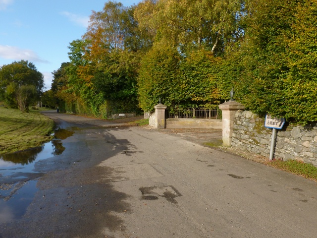
Access road in Shandon
This road runs parallel to the main road (the A814), but is quieter, providing access to houses on its eastern side. For example, the gateposts just ahead mark the start of the driveway to a house called Letrualt (the house was built in 1855 and extended in 1864; there used to be a farmstead of the same name Link on the hillside about 900 metres to the north).
 Map © Crown Copyright")
TIP: Click the map for more Large scale mapping
- Grid Square
- NS2586, 12 images (more nearby 🔍)
- Photographer
- Lairich Rig (more nearby)
- Date Taken
- Monday, 15 October, 2012 (more nearby)
- Submitted
- Thursday, 15 November, 2012
- Subject Location
-
OSGB36:
 NS 2549 8639 [10m precision]
WGS84: 56:2.3099N 4:48.1668W - Camera Location
-
OSGB36: NS 2553 8632
- View Direction
- North-northwest (about 337 degrees)