2001
TR2647 : St Andrew, Shepherdswell, Kent - East end
taken 23 years ago, near to Shepherdswell or Sibertswold, Kent, England
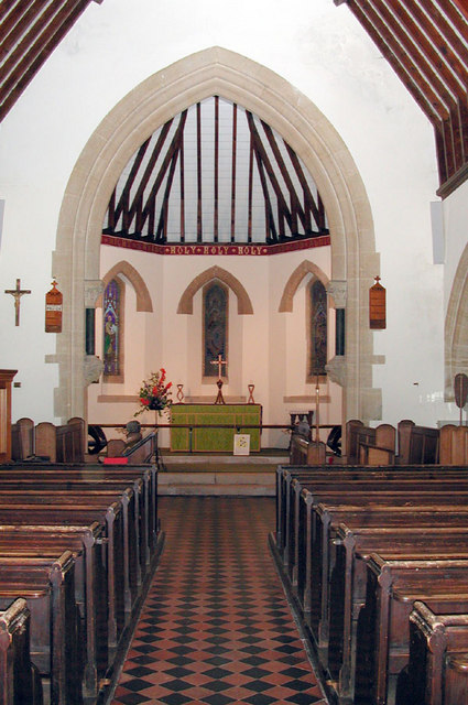
St Andrew, Shepherdswell, Kent - East end
 Map © Crown Copyright")
TIP: Click the map for more Large scale mapping
- Grid Square
- TR2647, 113 images (more nearby 🔍)
- Photographer
- John Salmon (more nearby)
- Date Taken
- Wednesday, 22 August, 2001 (more nearby)
- Submitted
- Sunday, 28 January, 2007
- Subject Location
-
OSGB36:
 TR 262 477 [100m precision]
WGS84: 51:11.0407N 1:14.1369E