2012
SP0883 : School Zone
taken 11 years ago, near to Moseley, Birmingham, England
School Zone
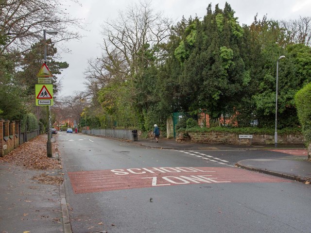
Looking NNW along Forest Road towards the junction with Oakland Road. The School Zone painted onto the road surface, and the traffic calming measures relate to the school that is behind the trees and fencing in the background.
It is St. Martin de Porres, voluntary aided Roman Catholic Primary School. Link
It is St. Martin de Porres, voluntary aided Roman Catholic Primary School. Link
 Map © Crown Copyright")
TIP: Click the map for more Large scale mapping
- Grid Square
- SP0883, 47 images (more nearby 🔍)
- Photographer
- David P Howard (more nearby)
- Date Taken
- Thursday, 22 November, 2012 (more nearby)
- Submitted
- Thursday, 22 November, 2012
- Subject Location
-
OSGB36:
 SP 0814 8325 [10m precision]
WGS84: 52:26.8292N 1:52.8997W - Camera Location
-
OSGB36: SP 0815 8323
- View Direction
- North-northwest (about 337 degrees)