2012
NN8285 : The trig point at Point 912m, 10m higher than the adjacent Leathad an Taobhain
taken 12 years ago, near to Leathad an Taobhain [hill or Mountain], Highland, Great Britain
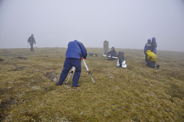
The trig point at Point 912m, 10m higher than the adjacent Leathad an Taobhain
On 15th June members of The Munro Society were checking the height as part of a programme to check heights of mountains marginally above or below 3,000 ft (914.4m). On this occasion the satellite readings confirmed that Leathad an Taobhain was a Corbett.
 Map © Crown Copyright")
TIP: Click the map for more Large scale mapping
- Grid Square
- NN8285, 9 images (more nearby 🔍)
- Photographer
- Iain A Robertson (more nearby)
- Date Taken
- Friday, 15 June, 2012 (more nearby)
- Submitted
- Thursday, 22 November, 2012
- Subject Location
-
OSGB36:
 NN 8217 8583 [10m precision]
WGS84: 56:56.9203N 3:56.3225W - Camera Location
-
OSGB36: NN 8212 8572
- View Direction
- North-northeast (about 22 degrees)