2007
SX6940 : Galmpton
taken 17 years ago, near to Galmpton, Devon, England
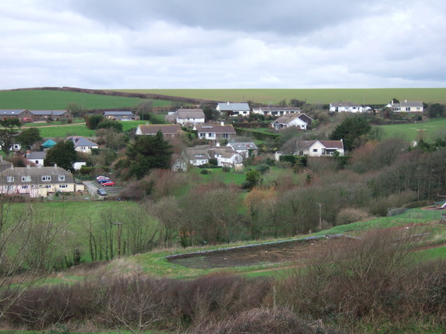
Galmpton
The core of the village, seen from South Huish Footpath 4 as it descends from the ridge separating the valley from the Bolberry valley. Thatched cottages and farms are now surrounded by bungalows and other modern dwellings. In the foreground is an empty midden at Burton Farm.
 Map © Crown Copyright")
TIP: Click the map for more Large scale mapping
- Grid Square
- SX6940, 24 images (more nearby 🔍)
- Photographer
- Derek Harper (more nearby)
- Date Taken
- Saturday, 27 January, 2007 (more nearby)
- Submitted
- Sunday, 28 January, 2007
- Subject Location
-
OSGB36:
 SX 692 403 [100m precision]
WGS84: 50:14.8904N 3:50.1551W - Camera Location
-
OSGB36: SX 6915 4005
- View Direction
- North-northeast (about 22 degrees)