2012
NS4275 : Whyte's Dam
taken 11 years ago, near to Milton, West Dunbartonshire, Scotland
This is 1 of 3 images, with title Whyte's Dam in this square
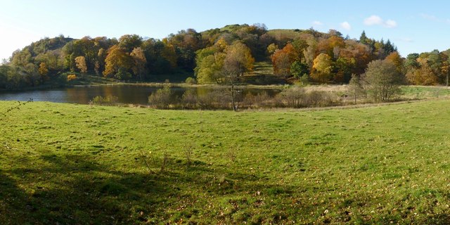
Whyte's Dam
The picture was taken from NS4275 : Milton Brae.
A local name for what the map calls Loch Bowie is Whyte's Dam (or White's Dam), perhaps named after the Whytes of NS4275 : Barnhill House; see NS4275 : Whyte's Dam for a different view, and for further information.
The name Loch Bowie is related to nearby Dumbowie Hill (see Link for details) whose two summits can be seen in the background, centre and right, of the present picture. On one of those summits are the remains of a fort, Dunbuie Dun (for which, see the link just given).
In the background, on the left, is part of Dumbuck Hill (on which, see NS4274 : Dumbuck Quarry).
 Map © Crown Copyright")
TIP: Click the map for more Large scale mapping
- Grid Square
- NS4275, 76 images (more nearby 🔍)
- Photographer
- Lairich Rig (more nearby)
- Date Taken
- Friday, 26 October, 2012 (more nearby)
- Submitted
- Sunday, 25 November, 2012
- Subject Location
-
OSGB36:
 NS 4246 7531 [10m precision]
WGS84: 55:56.6958N 4:31.4521W - Camera Location
-
OSGB36: NS 4258 7532
- View Direction
- WEST (about 270 degrees)