2007
SH6231 : Lane on edge of grid
taken 17 years ago, 4 km SSE of Eisingrug, Gwynedd, Wales
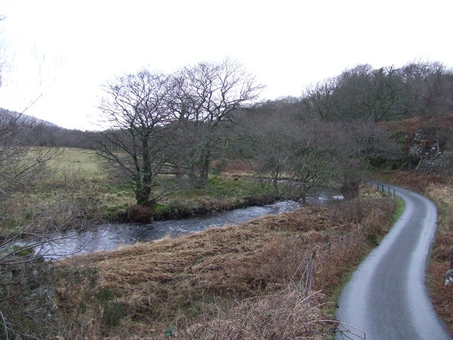
Lane on edge of grid
Noticed this section of the grid had not been photographed even though it was on the way up to the Roman steps. Drove to a safe parking spot and then walked back down the lane to get this picture where the road meets the river right on the edge of the grid square. The rest of the grid is made up of the small wood in the background and is not very accessible.
 Map © Crown Copyright")
TIP: Click the map for more Large scale mapping
- Grid Square
- SH6231, 11 images (more nearby 🔍)
- Photographer
- Richard cattel (more nearby)
- Date Taken
- Sunday, 28 January, 2007 (more nearby)
- Submitted
- Monday, 29 January, 2007
- Subject Location
-
OSGB36:
 SH 628 311 [100m precision]
WGS84: 52:51.5974N 4:2.3048W - Camera Location
-
OSGB36: SH 629 312
- View Direction
- South-southwest (about 202 degrees)