2012
SE0287 : Benchmark on wall pier of Morpeth Gate gateway
taken 12 years ago, near to West Burton, North Yorkshire, England
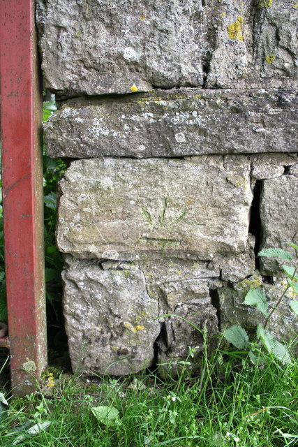
Benchmark on wall pier of Morpeth Gate gateway
Ordnance Survey cut mark benchmark described on the Bench Mark Database at Link
 Map © Crown Copyright")
TIP: Click the map for more Large scale mapping
- Grid Square
- SE0287, 66 images (more nearby 🔍)
- Photographer
- Roger Templeman (more nearby)
- Date Taken
- Monday, 25 June, 2012 (more nearby)
- Submitted
- Tuesday, 27 November, 2012
- Subject Location
-
OSGB36:
 SE 0241 8733 [10m precision]
WGS84: 54:16.8962N 1:57.8692W - Camera Location
-
OSGB36: SE 0241 8733
- View Direction
- Northeast (about 45 degrees)