2012
ST6761 : Valley of the Coneygre Brook
taken 11 years ago, near to Marksbury, Bath And North East Somerset, England
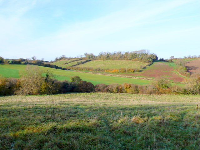
Valley of the Coneygre Brook
The line of the stream in the bottom of the valley is marked by the line of the bushes in the middle foreground. The dry valley in the middle distance runs up towards the village of Marksbury.
 Map © Crown Copyright")
TIP: Click the map for more Large scale mapping
- Grid Square
- ST6761, 28 images (more nearby 🔍)
- Photographer
- Nigel Mykura (more nearby)
- Date Taken
- Sunday, 18 November, 2012 (more nearby)
- Submitted
- Wednesday, 5 December, 2012
- Subject Location
-
OSGB36:
 ST 6731 6152 [10m precision]
WGS84: 51:21.1085N 2:28.2483W - Camera Location
-
OSGB36: ST 6747 6107
- View Direction
- North-northwest (about 337 degrees)