2012

SY2699 : Millgreen

taken 11 years ago, near to Kilmington, Devon, England
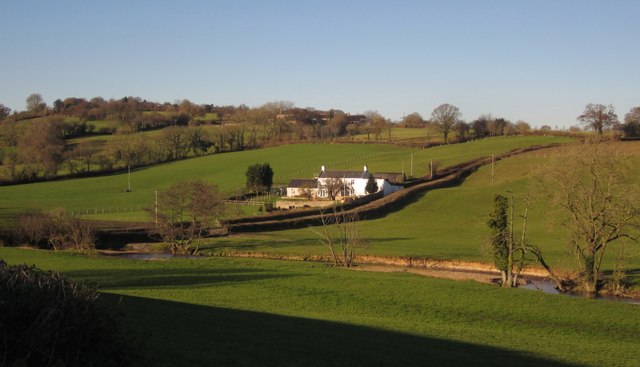
Millgreen
Millgreen
From Millgreen Lane, looking across the Corry Brook. Above it on the hillside, behind trees, is Dulcis Farm.

Creative Commons Licence [Some Rights Reserved]   © Copyright Derek Harper and licensed for reuse under this Creative Commons Licence.
Geographical Context: Lowlands Farm, Fishery, Market Gardening Rivers, Streams, Drainage Housing, Dwellings Roads, Road transport Stream: Corry Brook other tags: Farms House Farmland Pasture Trees Click a tag, to view other nearby images.
This photo is linked from: Automatic Clusters: · Millgreen [5] · Dulcis Farm [3] · Millgreen Farm [3] · Hillside [2] ·
1:50,000 Modern Day Landranger(TM) Map © Crown Copyright
+
+
1:50,000 Modern Day Landranger(TM) Map © Crown Copyright
TIP: Click the map for more Large scale mapping
Grid Square
SY2699, 13 images   (more nearby 🔍)
Photographer
Derek Harper   (more nearby)
Date Taken
Wednesday, 5 December, 2012   (more nearby)
Submitted
Tuesday, 11 December, 2012
Subject Location
OSGB36: geotagged! SY 269 991 [100m precision]
WGS84: 50:47.2106N 3:2.3019W
Camera Location
OSGB36: geotagged! SY 2708 9895
View Direction
Northwest (about 315 degrees)
Clickable map
+
NW N NE
W Go E
SW S SE
Image classification(about): Supplemental image
This page has been viewed about 27 times
You are not logged in login | register