2002
SJ2243 : Castell Dinas Bran
taken 22 years ago, near to Llangollen, Denbighshire/Sir Ddinbych, Wales
This is 1 of 28 images, with title Castell Dinas Bran in this square
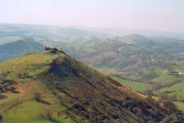
Castell Dinas Bran
An isolated, steep sided hill that formed an excellent defensive site for the castle builders.
 Map © Crown Copyright")
TIP: Click the map for more Large scale mapping
- Grid Square
- SJ2243, 162 images (more nearby 🔍)
- Photographer
- Gordon Hatton (more nearby)
- Date Taken
- April 2002 (more nearby)
- Submitted
- Thursday, 1 February, 2007
- Subject Location
-
OSGB36:
 SJ 223 430 [100m precision]
WGS84: 52:58.7542N 3:9.4847W - Camera Location
-
OSGB36: SJ 228 436
- View Direction
- Southwest (about 225 degrees)