2007
TQ8760 : Firs Farm from Blind Mary's Lane
taken 17 years ago, near to Bredgar, Kent, England
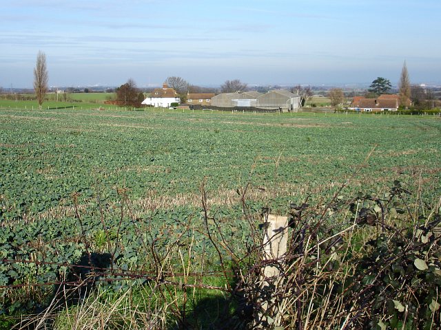
Firs Farm from Blind Mary's Lane
This farm used to have a huge flock of sheep and this field was pasture. The shepherd was housed in the bungalow on the right and lambing took place in the large barns between there and the farmhouse, left. The 'crop' here seems to be self-sown oil-seed rape.
 Map © Crown Copyright")
TIP: Click the map for more Large scale mapping
- Grid Square
- TQ8760, 118 images (more nearby 🔍)
- Photographer
- Penny Mayes (more nearby)
- Date Taken
- Wednesday, 31 January, 2007 (more nearby)
- Submitted
- Thursday, 1 February, 2007
- Subject Location
-
OSGB36:
 TQ 874 602 [100m precision]
WGS84: 51:18.6136N 0:41.2607E - Camera Location
-
OSGB36: TQ 873 599
- View Direction
- NORTH (about 0 degrees)