2012

SX8177 : About the muffle kilns, Bovey Tracey

taken 12 years ago, near to Bovey Tracey, Devon, England
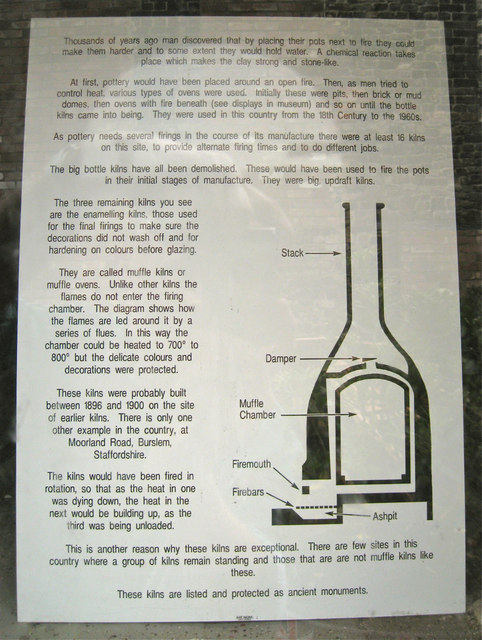
About the muffle kilns, Bovey Tracey
This explanation (photographed through glass) is on one of the three preserved muffle kins at House of Marbles. Larger size available: click top right. A view of the base of the kiln is SX8177 : Base of a muffle kiln, former pottery and all three kilns are seen at SX8177 : Bottle kilns at the old pottery.
Bovey Tracey potteries

The village of Bovey Tracey became the focus of a pottery industry that exploited the fine clay, known as ball clay, found in the basin of the River Bovey. In 1750 Lord William Courtenay, Earl of Devon, opened the clay and lignite pit at what is now known as Blue Waters. Potters from Staffordshire established potteries in the village that produced creamware, pearlware, printed blue ware and over the years many other ceramic products, the best of which rivalled that of Staffordshire in quality. It was hoped that the lignite (brown coal) would fuel the kilns but the required temperature for fine china could not be reached so coal was imported via the Stover Canal.

"There is a wealth of Bovey Tracey pottery, much of it unidentified, awaiting collectors all over the world."

Information from: Brian Adams. Bovey Tracey Potteries: Guide and Marks. Published by House of Marbles, Bovey Tracey, 2005. ISBN 0-9549744-0-9. Mr Adams is curator of the pottery museum at House of Marbles. Recommended.


Creative Commons Licence [Some Rights Reserved]   © Copyright Robin Stott and licensed for reuse under this Creative Commons Licence.
1:50,000 Modern Day Landranger(TM) Map © Crown Copyright
+
1:50,000 Modern Day Landranger(TM) Map © Crown Copyright
TIP: Click the map for more Large scale mapping
Grid Square
SX8177, 93 images   (more nearby 🔍)
Photographer
Robin Stott   (more nearby)
Date Taken
Wednesday, 6 June, 2012   (more nearby)
Submitted
Friday, 28 December, 2012
Subject Location
OSGB36: geotagged! SX 8154 7719 [10m precision]
WGS84: 50:34.9437N 3:40.4746W
Camera Location
OSGB36: geotagged! SX 8154 7719
View Direction
WEST (about 270 degrees)
Clickable map
+
NW N NE
W Go E
SW S SE
Image classification(about): Supplemental image
This page has been viewed about 103 times
You are not logged in login | register