2012
NR7421 : Shoreline Gateway
taken 11 years ago, 3 km from Kildalloig, Argyll And Bute, Scotland
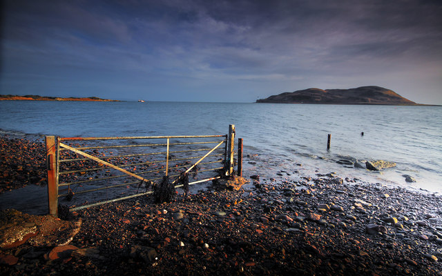
Shoreline Gateway
The gate marks the entry of a nearby land drain into the sea. The island is Davaar and the headland to the left is Macringans Point. The white dot nearby is the 'Argent', a grounded Irish fishing vessel.
 Map © Crown Copyright")
TIP: Click the map for more Large scale mapping
- Grid Square
- NR7421, 31 images (more nearby 🔍)
- Photographer
- Steve Partridge (more nearby)
- Date Taken
- Saturday, 29 December, 2012 (more nearby)
- Submitted
- Sunday, 30 December, 2012
- Subject Location
-
OSGB36:
 NR 7484 2130 [10m precision]
WGS84: 55:26.0209N 5:33.6361W - Camera Location
-
OSGB36: NR 7483 2130
- View Direction
- Southeast (about 135 degrees)