2012
NG7600 : Inverie: a shoreline view to the village
taken 12 years ago, near to Inverie, Highland, Scotland
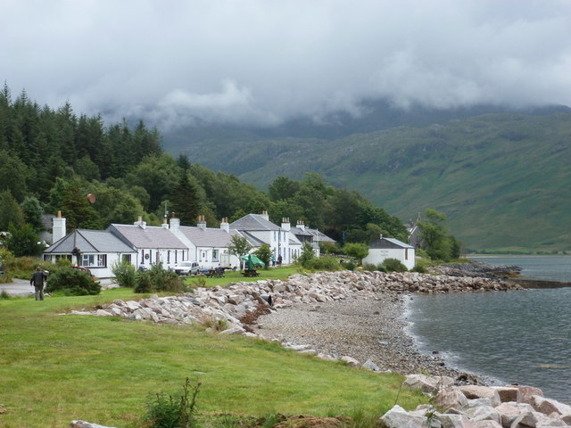
Inverie: a shoreline view to the village
While the sun tries its best to come out, we look along the shore towards the main part of the village, with the pub, the Old Forge, the first building on the left, and the tea room on the right, the only building between the road and the shore.
 Map © Crown Copyright")
TIP: Click the map for more Large scale mapping
- Grid Square
- NG7600, 71 images (more nearby 🔍)
- Photographer
- Chris Downer (more nearby)
- Date Taken
- Monday, 6 August, 2012 (more nearby)
- Submitted
- Wednesday, 9 January, 2013
- Subject Location
-
OSGB36:
 NG 7667 0005 [10m precision]
WGS84: 57:2.2372N 5:40.9547W - Camera Location
-
OSGB36: NG 7654 0015
- View Direction
- Southeast (about 135 degrees)