2007
SJ5045 : Line of disused railway, Bradley Common
taken 17 years ago, near to No Man's Heath, Cheshire West And Chester, England
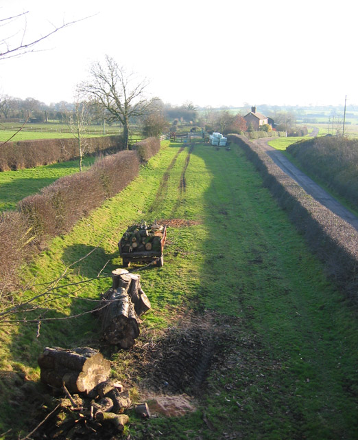
Line of disused railway, Bradley Common
The line of the disused railway running broadly N-S towards Whitchurch is easily visible here, being marked by banks topped with hedges. View southwards from the railway bridge on Bradley Lane, towards the railway bridge at Bradley Common. The track to Bradley Common runs off on the right, with the small mere just out of view on the right (SJ5045 : Reflections in mere at Bradley Common); the chapel (SJ5045 : Chapel at Bradley Common) is just out of sight on the left. In the foreground lies evidence of the high winds of January 2007
 Map © Crown Copyright")
TIP: Click the map for more Large scale mapping
- Grid Square
- SJ5045, 31 images (more nearby 🔍)
- Photographer
- Espresso Addict (more nearby)
- Date Taken
- Sunday, 4 February, 2007 (more nearby)
- Submitted
- Monday, 5 February, 2007
- Subject Location
-
OSGB36:
 SJ 509 456 [100m precision]
WGS84: 53:0.3757N 2:43.9723W - Camera Location
-
OSGB36: SJ 509 457
- View Direction
- South-southeast (about 157 degrees)