2007
SJ5045 : Narrow valley from Dodd's Lane
taken 17 years ago, near to Higher Wych, Cheshire West And Chester, England
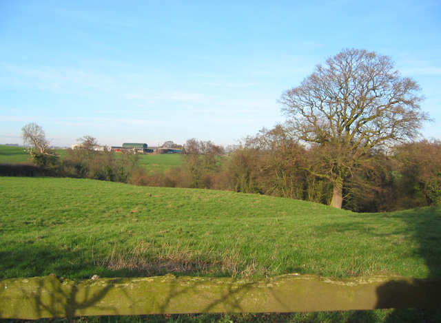
Narrow valley from Dodd's Lane
The narrow valley hiding an unnamed stream approaches close to the road at this point. The undulating pastureland surrounding the valley is typical of the gridsquare. The farm on the horizon is on the busy B5395
 Map © Crown Copyright")
TIP: Click the map for more Large scale mapping
- Grid Square
- SJ5045, 31 images (more nearby 🔍)
- Photographer
- Espresso Addict (more nearby)
- Date Taken
- Sunday, 4 February, 2007 (more nearby)
- Submitted
- Monday, 5 February, 2007
- Subject Location
-
OSGB36:
 SJ 504 453 [100m precision]
WGS84: 53:0.2061N 2:44.3539W - Camera Location
-
OSGB36: SJ 504 453
- View Direction
- Northeast (about 45 degrees)