2013
SD9726 : Canal boat on the Rochdale Canal near Charlestown
taken 11 years ago, near to Eastwood, Calderdale, England
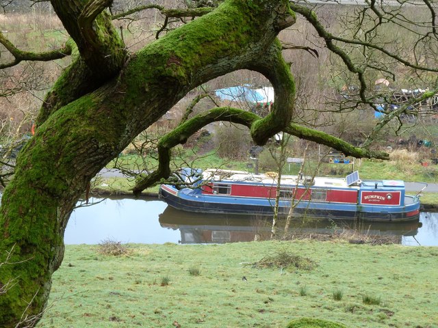
Canal boat on the Rochdale Canal near Charlestown
The Rochdale Canal runs for 33 miles between Manchester and Sowerby Bridge in West Yorkshire, UK. In Sowerby Bridge it connects with the Calder and Hebble Navigation. In Manchester it connects with the Ashton and Bridgewater Canals.
The canal was opened between Sowerby Bridge and Todmorden and from Manchester to Rochdale in 1799 and between Todmorden and Rochdale in 1805. Most of the canal was closed in 1952. Restoration work began in late 1980s and by 1996 the canal was opened to navigation once again between Sowerby Bridge and the summit level. The canal was re-opened to navigation along its entire length in July 2002 and forms part of the South Pennine Ring.
Link
See other images of Rochdale Canal
 Map © Crown Copyright")
TIP: Click the map for more Large scale mapping
- Grid Square
- SD9726, 136 images (more nearby 🔍)
- Photographer
- John Glasby (more nearby)
- Date Taken
- Wednesday, 9 January, 2013 (more nearby)
- Submitted
- Sunday, 20 January, 2013
- Subject Location
-
OSGB36:
 SD 972 264 [100m precision]
WGS84: 53:44.0390N 2:2.6354W - Camera Location
-
OSGB36: SD 973 264
- View Direction
- WEST (about 270 degrees)