2013
TQ2076 : Thames Bank, Mortlake
taken 11 years ago, near to Mortlake, Richmond Upon Thames, England
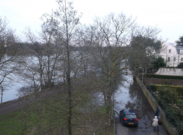
Thames Bank, Mortlake
As seen from Chiswick Bridge, looking down at the access road that leads to various houses along the riverfront.
Due to recent heavy rains, the river thames has broke its banks here and flooded the road and the Thames Path (long distance path between Chiswick and Barnes).
Due to recent heavy rains, the river thames has broke its banks here and flooded the road and the Thames Path (long distance path between Chiswick and Barnes).
River Thames
The River Thames rises at Thames Head in Gloucestershire on the slopes of the Cotswolds and flows generally eastward to its mouth near Southend in Essex. At 215 miles long it is one of the longest rivers in Britain, and the longest entirely within England. It is one of the most important rivers in Britain. Link

Thames Path
This National Trail is 184 miles (294 km) long, following the River Thames from its source in the Cotswolds almost to the sea, finishing at the Thames Barrier in Greenwich.
The trail keeps to the banks of the river most of the route.
Website: Link
 Map © Crown Copyright")
TIP: Click the map for more Large scale mapping
- Grid Square
- TQ2076, 221 images (more nearby 🔍)
- Photographer
- David Anstiss (more nearby)
- Date Taken
- Sunday, 13 January, 2013 (more nearby)
- Submitted
- Monday, 21 January, 2013
- Subject Location
-
OSGB36:
 TQ 2023 7622 [10m precision]
WGS84: 51:28.3308N 0:16.2201W - Camera Location
-
OSGB36: TQ 2020 7624
- View Direction
- East-southeast (about 112 degrees)