J4288 : New bridge, Downshire station, Carrickfergus
taken 27 years ago, near to Carrickfergus, Co Antrim, Northern Ireland
The line between Belfast York Road and Larne Harbour opened as far to Carrickfergus in 1848 and from Carrickfergus to Larne Harbour in 1862. There were stations at Belfast York Road (1848), Greencastle (1849/1916), Whitehouse (old station 1861/1906 replaced by a new station, further north 1906/1954), Whiteabbey (1848), Bleach Green 1934/1977), Jordanstown (by 1853), Trooperslane (by 1850), Mount (1925/72), Carrickfergus (old station 1848/62), Clipperstown (1925), Carrickfergus (1862), Barn (1925/77), Downshire (originally Downshire Park, 1925), Eden (1925/77), Kilroot (1862/77), Whitehead (first station 1863/64), Whitehead (second station 1864/77), Whitehead (1877), Whitehead Excursion (1907), Ballycarry (1862), Ballylig (now Magheramorne, 1862), Glynn (1864), Larne (1862/1974), Larne Town (new alignment, 1974) and Larne Harbour (1862).
York Road station closed in 1992, replaced by Yorkgate (on a different site) as part of the opening of the new cross-harbour line to Belfast Central.
The line between Belfast Central and Bleach Green Jct is also used by trains serving the Londonderry/Portrush lines.
Sources: Irish Railways Today (1967), the Northern Counties Railway (1973) and Johnsons Atlas & Gazetteer of the Railways of Ireland (1997).
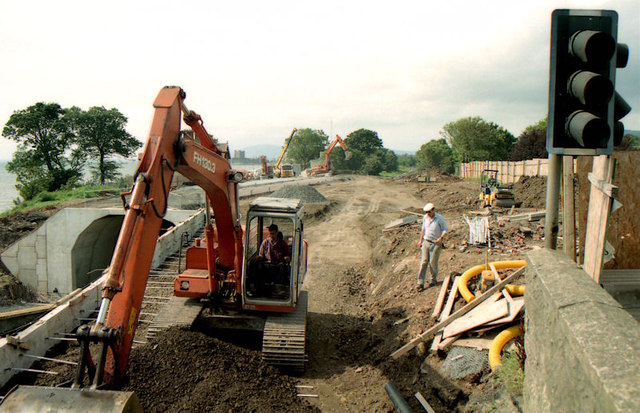
Some photographs showing the rebuilding of the bridge, carrying the Larne Road over the railway, at Downshire station and the railway relaying undertaken at the same time. It seems to have been built in the late 1920s when the line was doubled between Carrickfergus and Whitehead see also J4187 : Widened railway bridge, Carrickfergus (1) and J4187 : Widened railway bridge, Carrickfergus (2).
- Grid Square
- J4288, 43 images (more nearby 🔍)
- Photographer
- Albert Bridge (more nearby)
- Date Taken
- Saturday, 16 August, 1997 (more nearby)
- Submitted
- Wednesday, 23 January, 2013
- Subject Location
-
Irish:
 J 423 880 [100m precision]
WGS84: 54:43.2404N 5:47.5205W - Camera Location
-
Irish: J 423 880
- View Direction
- Southwest (about 225 degrees)