2007
NN2244 : Pony path, Allt Ghabhar
taken 17 years ago, near to Sròn a' Ghearrain [hill or Mountain], Highland, Great Britain
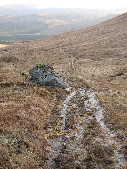
Pony path, Allt Ghabhar
Straight section of path below Màm nan Sac. There is very little sign of heavy walker use, yet it is an obvious descent route from Stob Ghabhar. The upper parts suffer from blocked water bars, and the surface is wet and worn in places. Work is being done on the track though.
 Map © Crown Copyright")
TIP: Click the map for more Large scale mapping
- Grid Square
- NN2244, 5 images (more nearby 🔍)
- Photographer
- Richard Webb (more nearby)
- Date Taken
- Saturday, 3 February, 2007 (more nearby)
- Submitted
- Tuesday, 6 February, 2007
- Subject Location
-
OSGB36:
 NN 224 441 [100m precision]
WGS84: 56:33.3122N 4:53.4415W - Camera Location
-
OSGB36: NN 223 442
- View Direction
- South-southeast (about 157 degrees)