2007
SU2209 : Track north of Slufters Pond, New Forest
taken 17 years ago, 3 km from Linwood, Hampshire, England
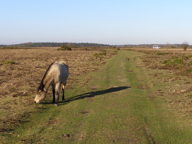
Track north of Slufters Pond, New Forest
This track is along the course of the old road from the A31 to Ocknell Plain. The white minibus on the right is headed along the new road which dips down through Slufters Inclosure and under the A31 dual carriageway on its way to Bolderwood. The conifers in the distance are part of Holly Hatch Inclosure.
 Map © Crown Copyright")
TIP: Click the map for more Large scale mapping
- Grid Square
- SU2209, 37 images (more nearby 🔍)
- Photographer
- Jim Champion (more nearby)
- Date Taken
- Saturday, 3 February, 2007 (more nearby)
- Submitted
- Tuesday, 6 February, 2007
- Subject Location
-
OSGB36:
 SU 221 097 [100m precision]
WGS84: 50:53.1822N 1:41.2317W - Camera Location
-
OSGB36: SU 221 097
- View Direction
- North-northeast (about 22 degrees)