2013
TQ0959 : The Lake, Painshill Park
taken 11 years ago, near to Whiteley Village, Surrey, England
This is 1 of 6 images, with title The Lake, Painshill Park in this square
The Lake, Painshill Park
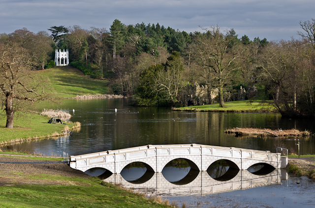
The Lake at Painshill Park, with the Five Arch Bridge (see TQ0959 : Five Arch Bridge). In the background on the left is the Gothic Temple. Compare TQ0959 : View from Turkish Tent for view before the building of the bridge.
Painshill Park
Painshill Park near Cobham, Surrey, is one of the finest remaining examples of an 18th century English landscape park. It was designed and created between 1738 and 1773 by the Hon. Charles Hamilton (MP).
Painshill Park is owned by Elmbridge Borough Council and managed by the Painshill Park Trust. Painshill, which is open to the public (with entry charge), has a Grade 1 Heritage listing. In 1998 Painshill Park was awarded the Europa Nostra Medal for the "Exemplary restoration from a state of extreme neglect, of a most important 18th century landscape park and its extraordinary buildings
LinkLink
 Map © Crown Copyright")
TIP: Click the map for more Large scale mapping
- Grid Square
- TQ0959, 97 images (more nearby 🔍)
- Photographer
- Ian Capper (more nearby)
- Date Taken
- Saturday, 16 February, 2013 (more nearby)
- Submitted
- Saturday, 23 February, 2013
- Subject Location
-
OSGB36:
 TQ 092 599 [100m precision]
WGS84: 51:19.7103N 0:26.0371W - Camera Location
-
OSGB36: TQ 090 599
- View Direction
- EAST (about 90 degrees)