2011
SH5744 : Moel-ddu Summits
taken 13 years ago, 3 km from Prenteg, Gwynedd, Wales
This is 1 of 4 images, with title starting with Moel in this square
Moel-ddu Summits
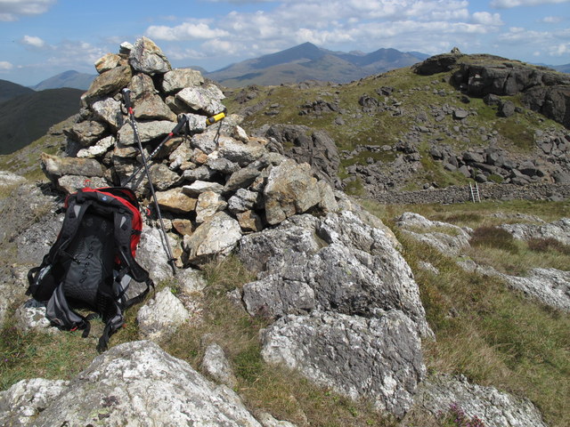
Walked in from minor road to SW, parked at last cattle grid as little space at corner. Great sunny morning. This is the view from the lower south westerly top across to the rugged summit.
Name: Moel-ddu
Hill number: 2037
Height: 553m / 1814ft
Area: 30B: Snowdonia
Class: Ma,5
Grid ref: SH 57965 44213
Summit feature: cairn
Drop: 198m
Col: 355m SH575449
Name: Moel-ddu
Hill number: 2037
Height: 553m / 1814ft
Area: 30B: Snowdonia
Class: Ma,5
Grid ref: SH 57965 44213
Summit feature: cairn
Drop: 198m
Col: 355m SH575449
 Map © Crown Copyright")
TIP: Click the map for more Large scale mapping
- Grid Square
- SH5744, 14 images (more nearby 🔍)
- Photographer
- Rude Health (more nearby)
- Date Taken
- Wednesday, 27 July, 2011 (more nearby)
- Submitted
- Tuesday, 26 February, 2013
- Subject Location
-
OSGB36:
 SH 5793 4418 [10m precision]
WGS84: 52:58.5652N 4:7.0385W - Camera Location
-
OSGB36: SH 5789 4414
- View Direction
- Northeast (about 45 degrees)