2007
SJ1756 : Field and Hedges
taken 17 years ago, near to Llanarmon-yn-Lal, Denbighshire/Sir Ddinbych, Wales
This is 1 of 2 images, with title starting with Field and in this square
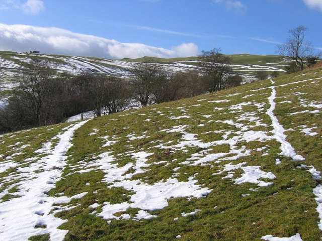
Field and Hedges
Looking across the hillside from the footpath to Garreg Lwyd. The corner of the field is approximately in the centre of the photo and the O.S. 25,000 scale map indicates that there is a well on the other side of the hedge at that point.
 Map © Crown Copyright")
TIP: Click the map for more Large scale mapping
- Grid Square
- SJ1756, 26 images (more nearby 🔍)
- Photographer
- John S Turner (more nearby)
- Date Taken
- Sunday, 11 February, 2007 (more nearby)
- Submitted
- Monday, 12 February, 2007
- Subject Location
-
OSGB36:
 SJ 178 567 [100m precision]
WGS84: 53:6.0685N 3:13.7497W - Camera Location
-
OSGB36: SJ 179 568
- View Direction
- Southwest (about 225 degrees)