2013
TA1028 : Another Angle on The Deep
taken 11 years ago, near to Kingston Upon Hull, England
This is 1 of 2 images, with title Another Angle on The Deep in this square
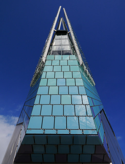
Another Angle on The Deep
Not apparent in this photo, but the camera position for this shot is vertical! The building overhangs by several metres above its base at this point as it points out south-westwards over the River Humber.
 Map © Crown Copyright")
TIP: Click the map for more Large scale mapping
- Grid Square
- TA1028, 3428 images (more nearby 🔍)
- Photographer
- Andy Beecroft (more nearby)
- Date Taken
- Monday, 11 March, 2013 (more nearby)
- Submitted
- Tuesday, 12 March, 2013
- Subject Location
-
OSGB36:
 TA 1021 2821 [10m precision]
WGS84: 53:44.3182N 0:19.8350W - Camera Location
-
OSGB36: TA 1019 2819
- View Direction
- Northeast (about 45 degrees)