2006
NO1906 : West Lomond
taken 18 years ago, near to Nether Urquhart, Fife, Scotland
This is 1 of 5 images, with title West Lomond in this square
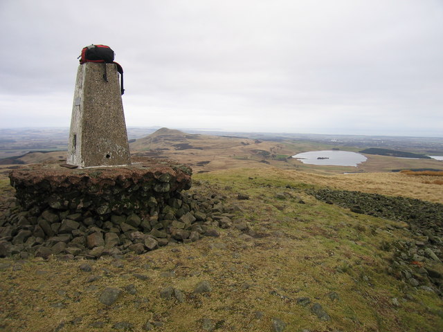
West Lomond
Fife (1974) administrative county top, Fife historic county top and Fife current county/UA top.
Name: West Lomond
Hill number: 1658
Height: 522m / 1713ft
Area: 26A: Central Scotland from Dumbarton to Montrose
Class: Ma,5D,CoH,CoU, CoA
Grid ref: NO 19732 06633
Summit feature: trig point
Drop: 405m
Col: 117m NO155065
Name: West Lomond
Hill number: 1658
Height: 522m / 1713ft
Area: 26A: Central Scotland from Dumbarton to Montrose
Class: Ma,5D,CoH,CoU, CoA
Grid ref: NO 19732 06633
Summit feature: trig point
Drop: 405m
Col: 117m NO155065
 Map © Crown Copyright")
TIP: Click the map for more Large scale mapping
- Grid Square
- NO1906, 66 images (more nearby 🔍)
- Photographer
- Rude Health (more nearby)
- Date Taken
- Wednesday, 25 January, 2006 (more nearby)
- Submitted
- Wednesday, 13 March, 2013
- Subject Location
-
OSGB36:
 NO 1973 0663 [10m precision]
WGS84: 56:14.7233N 3:17.8113W - Camera Location
-
OSGB36: NO 1971 0663
- View Direction
- East-southeast (about 112 degrees)