2013
NR4164 : Natural Dyke and Dun, Dunlossit Estate, Islay
taken 11 years ago, 3 km from Ballygrant, Islay, Argyll And Bute, Scotland
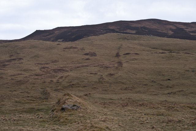
Natural Dyke and Dun, Dunlossit Estate, Islay
The natural dyke runs just right of centre from the summit of the dun to the foreground of the photo and onwards, north-west towards Beannan Buidhe. For another photo of this feature, see Link
 Map © Crown Copyright")
TIP: Click the map for more Large scale mapping
- Grid Square
- NR4164, 16 images (more nearby 🔍)
- Photographer
- Becky Williamson (more nearby)
- Date Taken
- Monday, 18 March, 2013 (more nearby)
- Submitted
- Monday, 18 March, 2013
- Subject Location
-
OSGB36:
 NR 4174 6435 [10m precision]
WGS84: 55:48.1909N 6:7.3657W - Camera Location
-
OSGB36: NR 4171 6437
- View Direction
- Southeast (about 135 degrees)