NG1550 : Lower Milovaig: postbox № IV55 58 and phone
taken 12 years ago, near to Lower Milovaig, Isle of Skye, Scotland
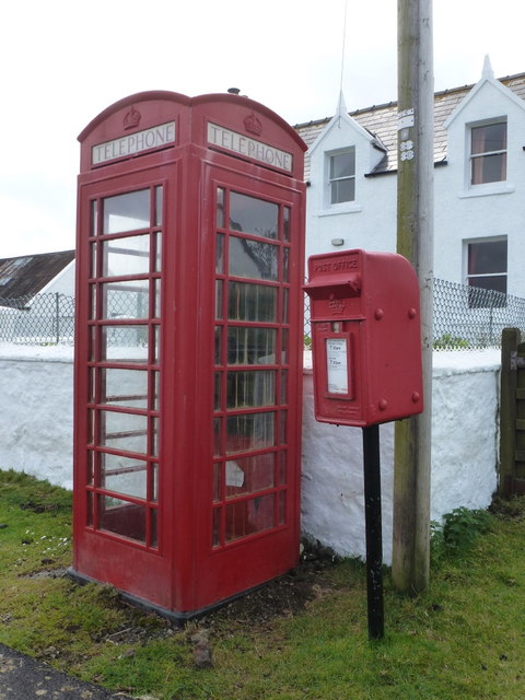
The iconic red telephone kiosk was the result of a competition in 1924 to design a telephone box suitable for London Metropolitan Boroughs. A design by Giles Gilbert Scott, a British Architect, was chosen. The box, to be known as the K2 was deployed in London in 1926. The post office suggested it be painted red.
The K6 was introduced in 1935, designed to commemorate the silver jubilee of King George V. It was a smaller version of the K2, and went on to be installed prolifically around the country. It is the most recognised and iconic telephone box, that many people around the world are familiar with. The first K6 is still to be found outside the Royal Academy of Art in London.
Other versions of the red telephone box were designed and implemented but none were ever to survive the popularity of the K6.
Over 240,000 red telephone boxes were built between the 1920s and 1980s.
BT had replaced many red telephone boxes during the 1980s and 90s with the aluminium KX100, leading to English Heritage to designate over 2000 as listed structures. Only 9400 K6's remain.
BT offered councils to 'adopt-a-kiosk' for £1 to keep local K6's in place. Many have found alternate uses as mini libraries/book exchanges & art galleries, and even for storage of heart defibrillators.
 Map © Crown Copyright")
- Grid Square
- NG1550, 47 images (more nearby 🔍)
- Photographer
- Chris Downer (more nearby)
- Date Taken
- Sunday, 19 August, 2012 (more nearby)
- Submitted
- Sunday, 24 March, 2013
- Subject Location
-
OSGB36:
 NG 1517 5006 [10m precision]
WGS84: 57:27.0690N 6:45.0066W - Camera Location
-
OSGB36: NG 1517 5008
- View Direction
- South-southwest (about 202 degrees)