2013
SP4613 : Oak
taken 11 years ago, near to Begbroke, Oxfordshire, England
Oak
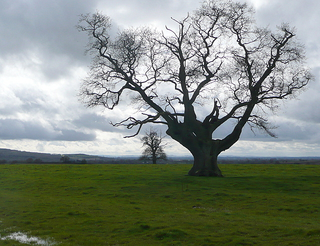
The 1:25,000 map not only marks a single tree here, but names it "oak". And here it is. The footpath used by Shakespeare's Way reaches the crest here and a great view opens up, westwards towards the Upper Thames valley.
Shakespeare's Way
Shakespeare's Way is a 146 mile long distance footpath from Shakespeare's birthplace in Stratford-upon-Avon to the Globe theatre in London. It follows as nearly as possible a route that Shakespeare may have taken between the two, but using footpaths, quiet lanes and towpaths, rather than his tracks, which are today's main roads.
 Map © Crown Copyright")
TIP: Click the map for more Large scale mapping
- Grid Square
- SP4613, 40 images (more nearby 🔍)
- Photographer
- Graham Horn (more nearby)
- Date Taken
- Saturday, 16 March, 2013 (more nearby)
- Submitted
- Sunday, 24 March, 2013
- Subject Location
-
OSGB36:
 SP 4628 1330 [10m precision]
WGS84: 51:48.9852N 1:19.8014W - Camera Location
-
OSGB36: SP 4630 1331
- View Direction
- Southwest (about 225 degrees)