2007
NZ1735 : Low Dowfold, Crook
taken 17 years ago, near to Crook, County Durham, England
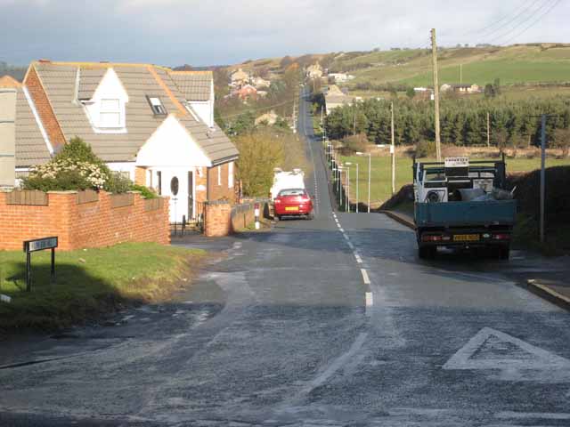
Low Dowfold, Crook
The switchback road from High Job's Hill to Low Job's Hill. Dowfold Hill NZ1736 in the distance.
 Map © Crown Copyright")
TIP: Click the map for more Large scale mapping
- Grid Square
- NZ1735, 15 images (more nearby 🔍)
- Photographer
- Oliver Dixon (more nearby)
- Date Taken
- Tuesday, 13 February, 2007 (more nearby)
- Submitted
- Wednesday, 14 February, 2007
- Subject Location
-
OSGB36:
 NZ 173 354 [100m precision]
WGS84: 54:42.8258N 1:43.9701W - Camera Location
-
OSGB36: NZ 174 350
- View Direction
- North-northwest (about 337 degrees)