2005
NX4501 : View from Lambhill to Cranstal footpath, Isle of Man
taken 19 years ago, near to Cranstal, Isle of Man
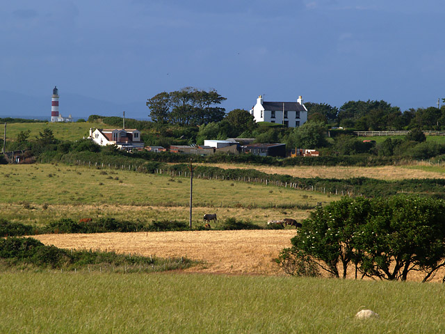
View from Lambhill to Cranstal footpath, Isle of Man
Taken looking north, showing a farm (Ballahard) on the A16 at Cranstal and, approximately 2.5 kms beyond that, the Point of Ayre lighthouse.
The Scottish hills are faintly visible too.
The Scottish hills are faintly visible too.
 Map © Crown Copyright")
TIP: Click the map for more Large scale mapping
- Grid Square
- NX4501, 7 images (more nearby 🔍)
- Photographer
- Andy Radcliffe (more nearby)
- Date Taken
- Friday, 5 August, 2005 (more nearby)
- Submitted
- Friday, 5 August, 2005
- Subject Location
-
OSGB36:
 NX 458 017 [100m precision]
WGS84: 54:23.2419N 4:22.5704W