1996
HP6317 : Brei Wick, Saxa Vord
taken 28 years ago, 3 km from Norwick, Unst, Shetland Islands, Scotland
This is 1 of 2 images, with title Brei Wick, Saxa Vord in this square
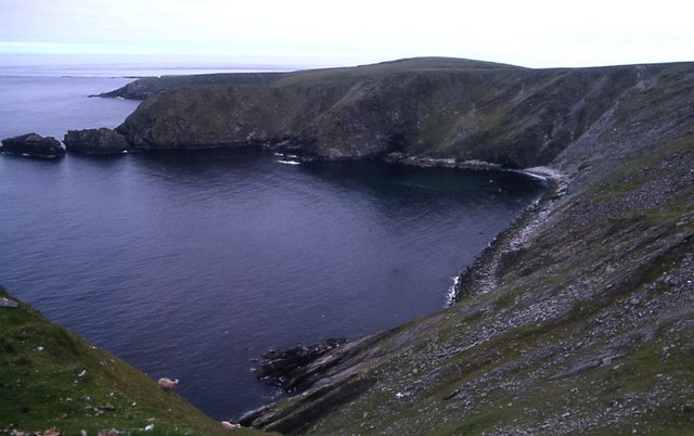
Brei Wick, Saxa Vord
A bay on the north side of Saxa Vord.
 Map © Crown Copyright")
TIP: Click the map for more Large scale mapping
- Grid Square
- HP6317, 19 images (more nearby 🔍)
- Photographer
- Mike Pennington (more nearby)
- Date Taken
- July 1996 (more nearby)
- Submitted
- Monday, 19 February, 2007
- Subject Location
-
OSGB36:
 HP 638 172 [100m precision]
WGS84: 60:49.9622N 0:49.6599W - Camera Location
-
OSGB36: HP 634 177
- View Direction
- Southeast (about 135 degrees)